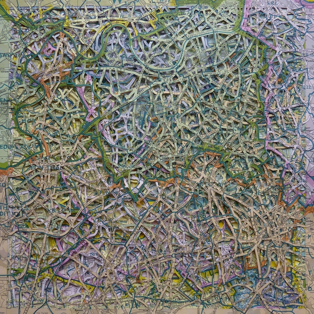
London Postal Districts
September 20, 2012
Posted by emma johnson
Filed in
Artworks Tagged:
altered,
art,
artwork,
atlas,
Britain,
British Isles,
cartography,
cities,
city,
cut,
deconstruction,
dissected,
dissection,
emma johnson,
fragmentation,
layered,
London,
map,
mapping,
paper,
Papercut,
papercuts,
river,
Thames

September 20, 2012 at 11:05 pm
Love it. Can you tell us more about this? They are layered postal areas I guess? All of them? All the same scale? What was the source map? Size of the finished piece?
That’s enough questions for now : )
September 21, 2012 at 9:18 am
Thanks Steve – I’m sorry I posted this in my usual haste and neglected to provide any useful information : )
The original source map was a Geographer’s A to Z Of London Postal Districts: an extremely garish sheet map (presumably from the 1980s, although I could find no date) which I cut into six equally sized square sections, dissected with a scalpel, and then layered on top of each other. The finished piece is 12 inches square (perfect album cover proportions : )
May 26, 2013 at 1:25 am
Do Brazil.
Gostei muito. Os mapas nos orientam e nos confundem.
Congratulações.
May 26, 2013 at 6:37 am
Obrigado!